The Power of an Air Monitor
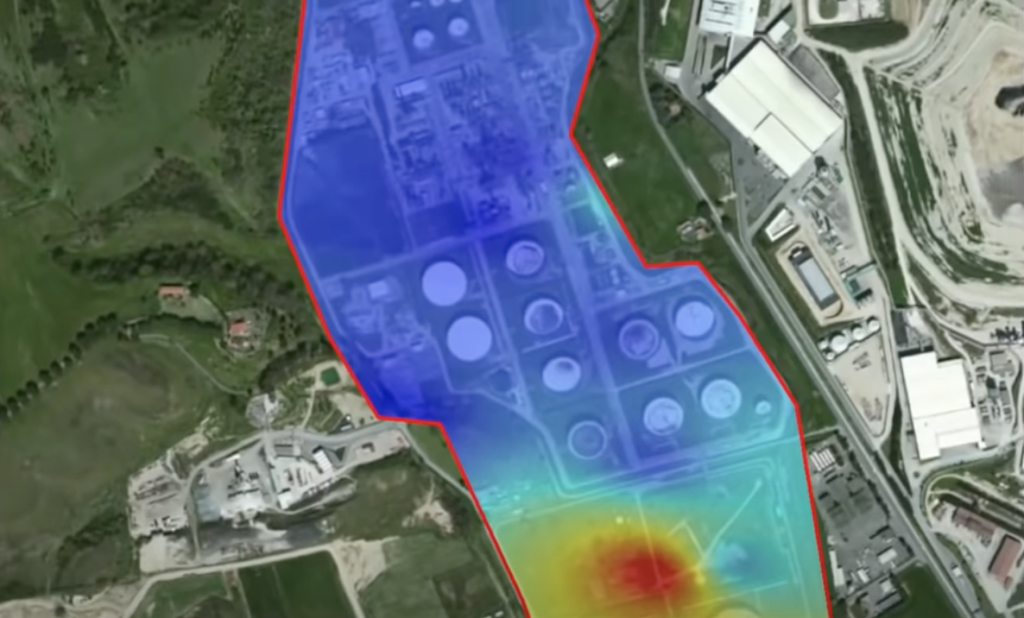
Drones are for much more than taking photographs these days. With advanced sensors like air monitors, mapping airspace is a real capability. The air monitors Skyfire utilizes are capable of live streaming the ingested air data to a cloud service via cellular connection and directly back to the ground station. The pilot can then respond to the sensor readings in real-time. The power of this information is fast, undeniable, and actionable.
From odor detection and identification, emergency response, environmental compliance, plume modeling, hazardous material identification and control, and health and safety placing an air monitor in the air makes perfect sense. After the flight, the data is then imported into GIS software to create a color-coded visualization of the area that you have mapped.
Feel free to contact us for sales, service, and training! dan@skyfireconsulting.com